Accelerate outcomes with AI-powered tools, on-demand insights and interactive experiences.
- Gartner client? Log in for personalized search results.
Gartner for IT Leaders
Top questions from IT leaders — and how we answer them
What are the most valuable AI use cases and how should organizations prioritize them?
Explore AI use cases tailored to your industry for stronger AI outcomes. |
How are my peers and other organizations obtaining business value with AI?
Learn how to accelerate enterprise AI value realization at scale. |
How can I use AI that’s aligned to our organization’s risk tolerance?
Drive AI innovation without exposing your enterprise to new risks. |
How do I ensure our data is AI-ready and meets quality demands for our use cases?
Unlock AI-first value with data and analytics. |
How can we adapt our software engineering strategy to account for AI?
Learn how to prepare your teams to deliver value in an AI-driven future. |
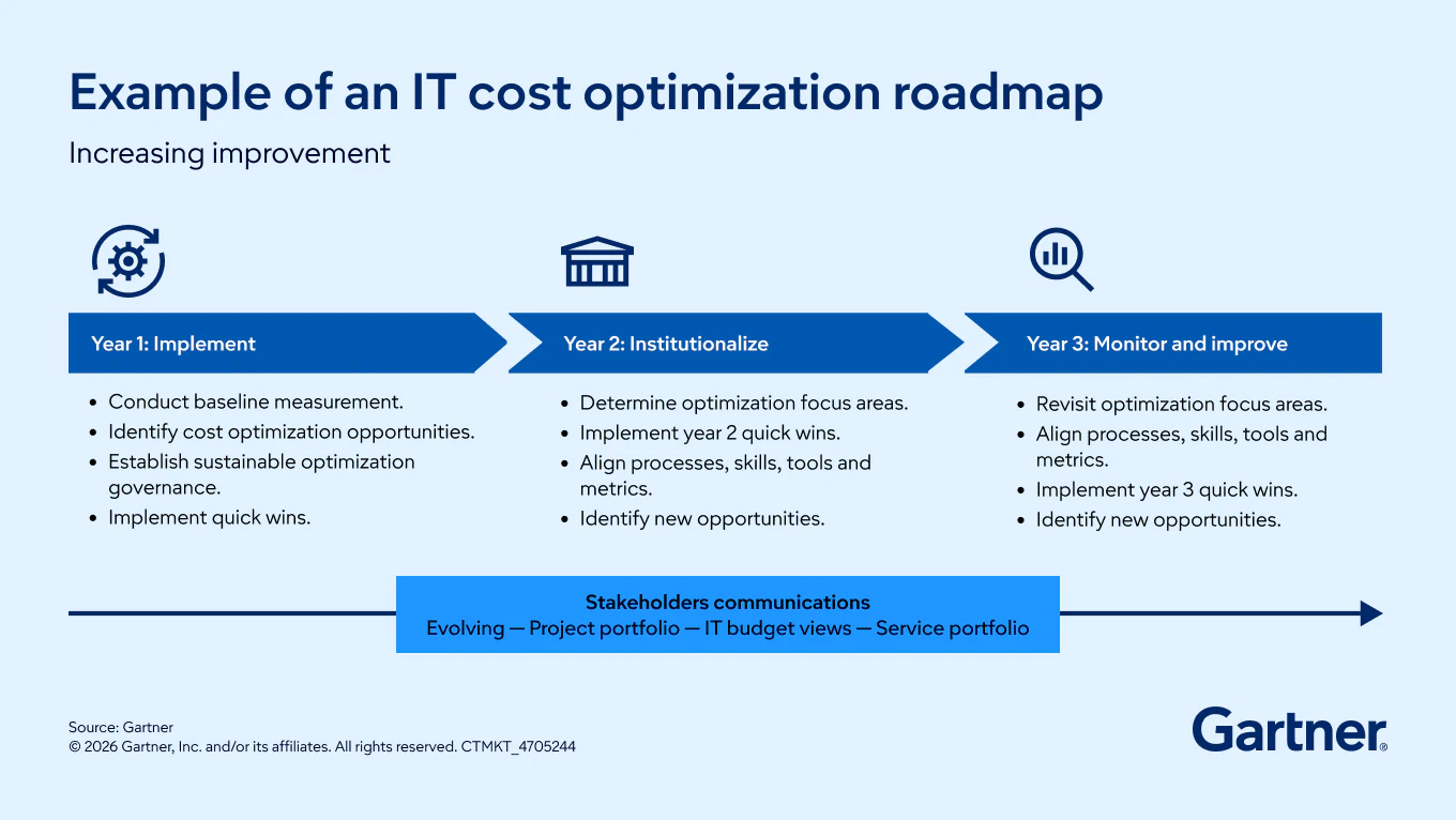
How can we avoid accruing more technical debt moving forward?
Prioritize technical debt reduction to enable efficiency and innovation. |
Which AI technologies and vendors are fit for our organization’s transformation objectives?
Streamline technology buying decisions to accelerate transformation. |
How Gartner supports IT leaders


The value we offer our clients
2,400+
business and technology analysts
510,000+
client interactions
23,000+
vendor briefings
815,000+
vetted peer reviews